
Map Fløyen Bergen
I was approached by Fløyen to design a map covering the different pathways and activities at Fløyen, and spent a good few months trailing every nook and corner to make sense of the normally red dotted lines. Good fun, and almost a treasure hunt!
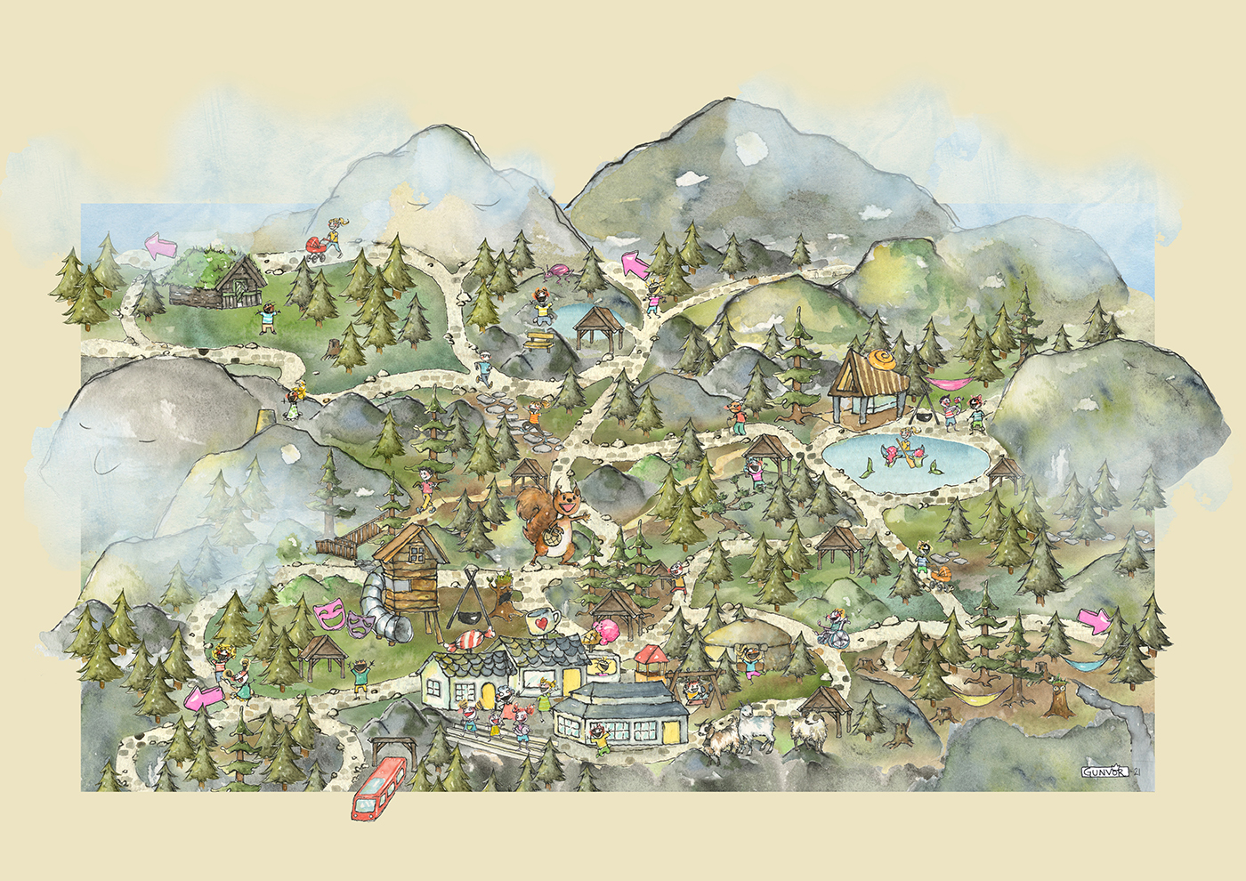
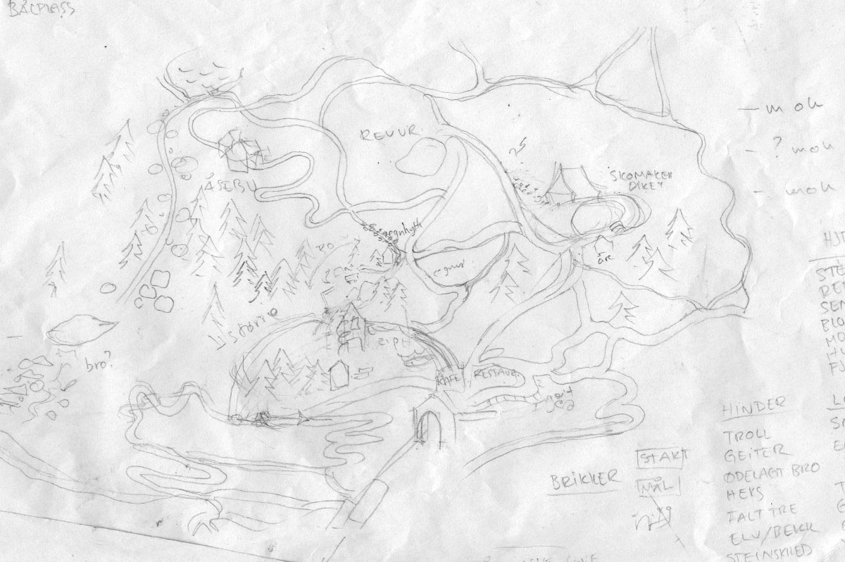
Sometimes things just line up neatly. I made this sketch after a walk at Fløyen, thinking the paths could be a fun starting point for a boardgame. The same day Fløyen A/S approached me asking me to do a map for them. The map would show experiences and places at the top of the funicular (playgrounds, lakes, shops, places to rest and explore, cafees, trails, hidden gems, best hammock views) and be readable and understandable for kids, with walks within half an hour reach from the top station. This meant I had to pay extra attention on my walks, what was actually there to discover.
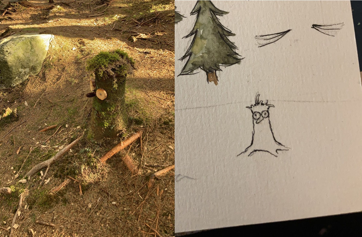
Like this guy. Not an essential part of navigating Mt Fløyen, but a treat to run into. (On the map: The treestump-creature is located in the forest after passing the goat house.)
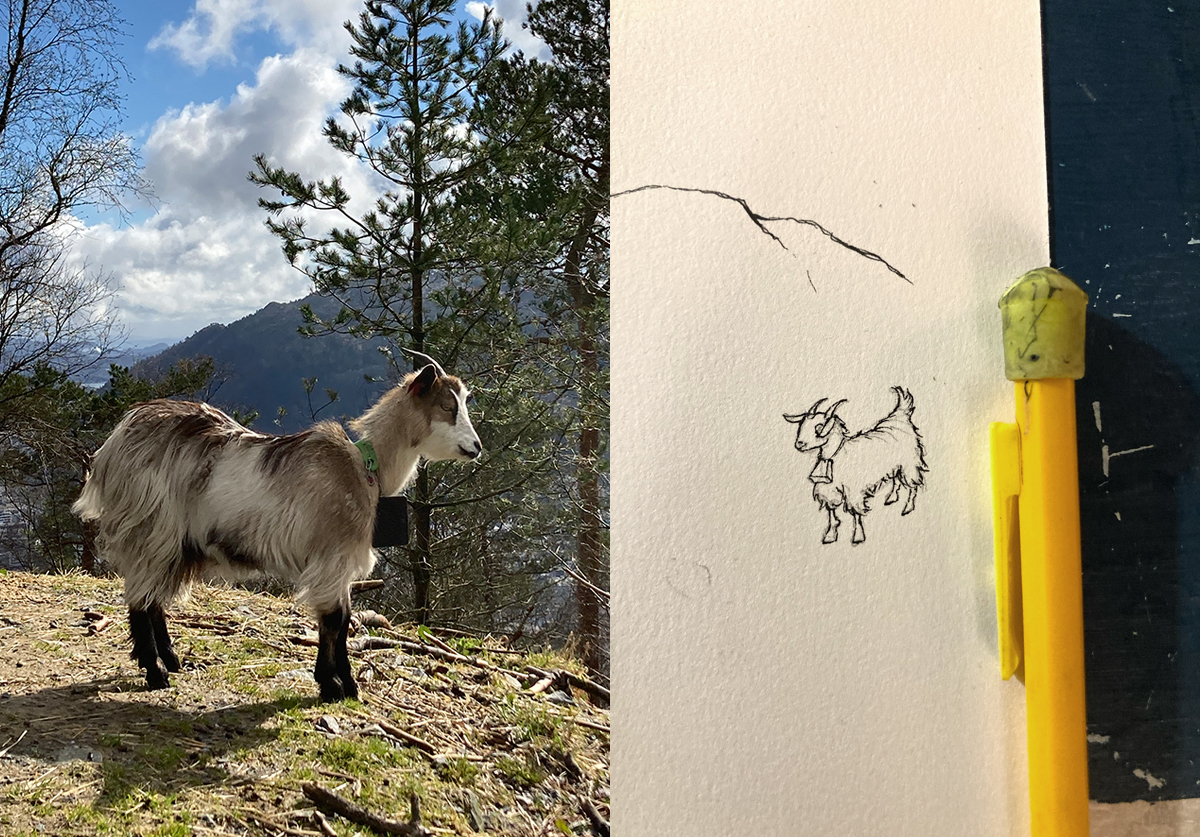
And of course the goats. With pencil for scale. Adding the goats is of course another non-essential detail for mapping (and they move around) but this map was to show things you could bump into. Maybe even spot people you know. I’ve added a few people I know, and they’re running towards eachother on the rocky path in the picture below.
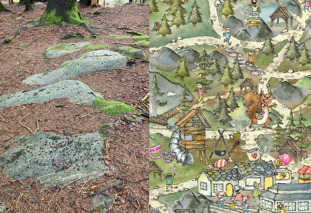
I varied the colour scheme roughly according to topography, so that rockier areas were more grey, mossy undergrowth were more green, and dense pine forest floors were brown. I’d love to have thrown in the different greenery more accurate, but I had to restrain the level of nerdy details or I would never finish.
You can find the map at the first crossing after leaving the top station.
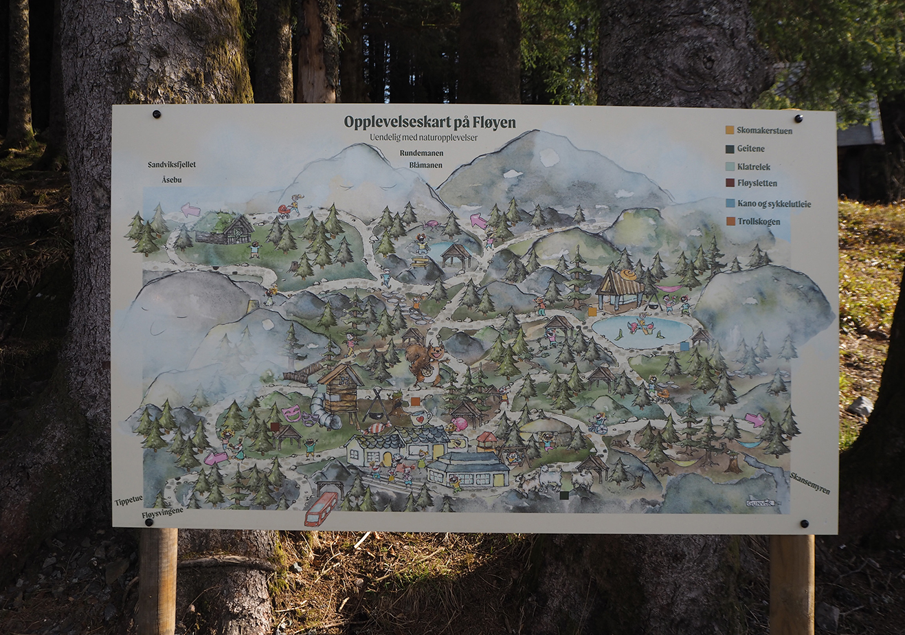
Map in my web shop here.